You Only Walk This Way Once
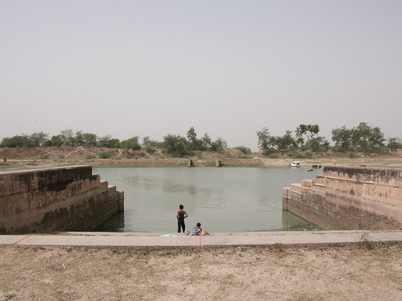
The Ganges River is India’s largest and most densely populated water basin. A lifeline to millions of people and carrying enormous celestial significance, the river is also severely polluted and suffers from dramatic droughts and floods. Vere van Gool spoke with Anthony Acciavatti to discuss the decade he spent navigating the Ganges and the new reading he was able to construct of this sacred river.
How did your journey begin?
I’ve always been interested in the relationship between rivers and cities. It’s something of a romance really. I grew up not far from the Mississippi river and after doing some mappings of the Tiber river in relationship to the city of Rome, I came back to the States and finished my undergraduate thesis where I was looking at the Atchafalaya basin of south New Orleans, designing from the scale of mosquito habitats to the regional hydrodynamics of the Mississippi. While working on my thesis, I became very interested in looking into a large river system and noticed that the Ganges hadn’t been mapped in about fifty years. All I could find were statistics attesting to its unprecedented levels of human density, agricultural production, and annual rainfall. So I wrote a Fulbright proposal in 2004, saying: if you give me a year, I will walk the land and create what I called a dynamic atlas of how the monsoon radically transforms this area every year.
What happened when you started the project, when you arrived in India?
I was hoping that I would find maps at universities or from the Survey of India, at least maps that were more recent than the 1960s. But I couldn’t find any, and when I would ask, a lot of times I would be questioned as to whether or not I was CIA. Stunned, I assured them I wasn’t but I never got to see any maps. So I had to really do what I proposed, to ‘walk the land’ and start developing guerilla tactics of mapping how cities and farms in this river basin change with the monsoon.
‘Walk the land’?
I’ve literally walked or boated two-thirds of the length of the Ganges river with just a handheld GPS and digital camera. So I was photographing and developing panoramas of these areas that I was walking, using a GPS to locate those areas in perspective then redrawing plans and sections from photographs. Before I left for India, my grandmother told me: “Just remember, you only walk this way once.” That was something that really stuck in my mind. I really only had one shot to do this and fill each day with as much as I could.
What was the larger goal of this research?
The larger goal was to map the choreography of water, soil, and settlement in relationship to the rhythms of the monsoons. By creating measured drawings I was hoping that other people would use this dynamic atlas to hallucinate alternative futures for this area, so it was always about creating a set of dynamics representation that could form the basis for design and engineering projects. I also started this work just as Katrina happened in New Orleans. There is so much we can learn from the Ganges in terms of living with dynamic rivers so that we don’t have a kind of repeat of what happened in New Orleans and elsewhere along the Mississippi. The Ganges basin undergoes dramatic droughts and floods, sometimes both in the same year. Many people there are very used to having to deal with capricious rainfall patterns. So I think there’s a lot that we can learn about how people negotiate and live in a terrain like that, for other parts of the world as well.
How did technology influence your methodology?
One of the reasons I proposed to go out and undertake all this fieldwork was that when I wrote the Fulbright proposal, Google Earth was just launched and it was still extremely low resolution for India. There’s a long history in India of maps being highly contested, which has continued with satellite imagery, too. I think we need to think about how we develop a technique of mapping that is more attuned to the social and environmental conditions that permeate this monsoonal landscape.
Most people know the Ganges through photos depicting either religious rituals or filth. Yet you used abstract tools such as line-drawings to represent the Ganges in your research. How does drawing allow one to see different things than photographs?
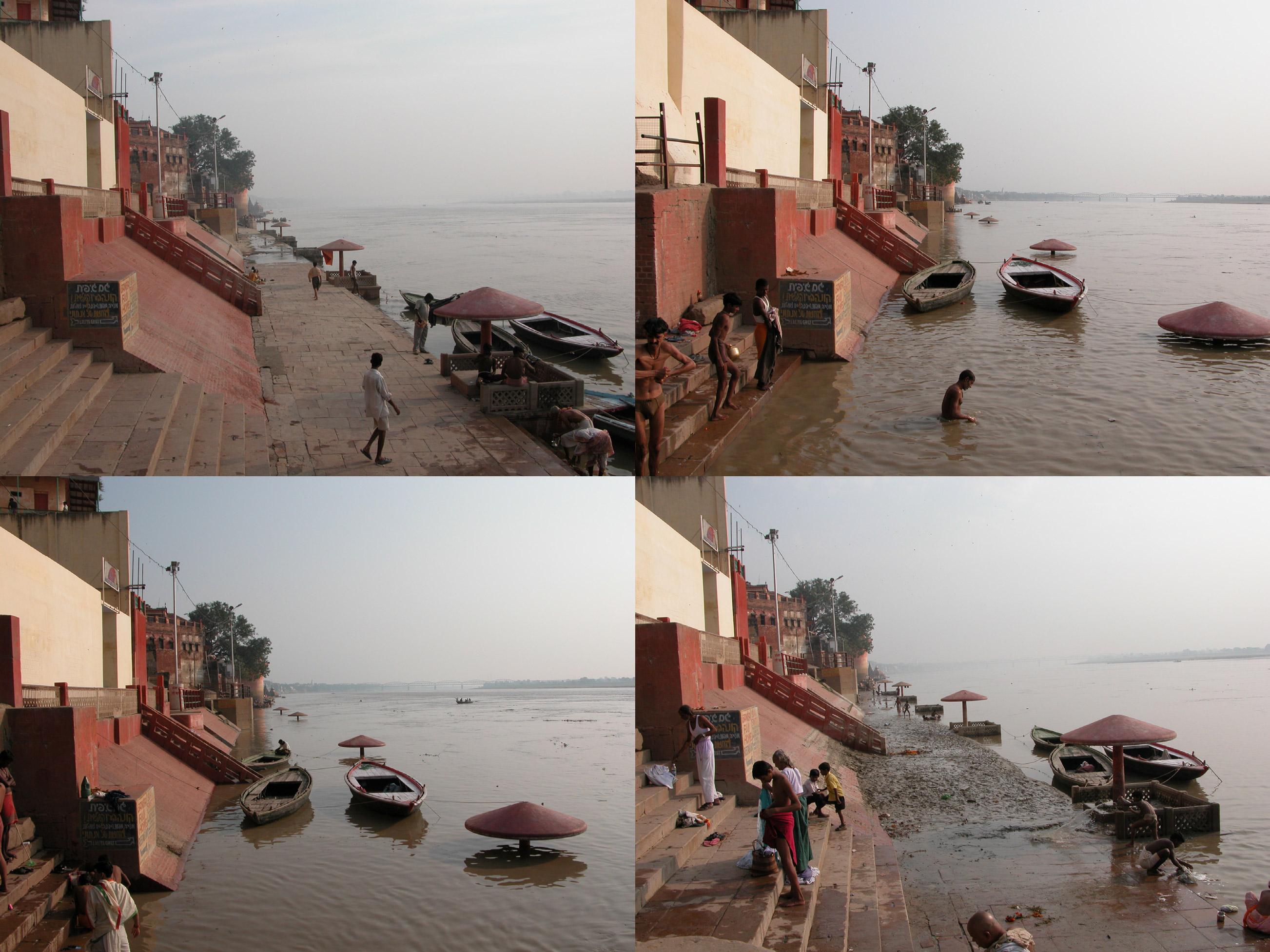
There are lots of private moments that happen on the river, and I’m not interested in being a voyeur. There are actually a lot of people portrayed in my book undertaking various activities over the course of a day, month, or year: from animal husbandry, mining sand from the riverbed, building temporary cities, performing pujas (acts of worship), farming, and boating. I tried to show the mixed use that is happening throughout the Ganges basin and represent the conflicts and the convergences of land and water.
There is certainly a distinct visual profile that I construct of the Ganges, but within that there is plenty of space for people to create their own narratives. Maybe not everyone has gotten that, but some have. I felt it was important for readers to have their own visual experience with the river, rather than me just telling them about mine.
You refer to your book, Ganges Water Machine: Designing New India’s Ancient River (Applied Research & Design, 2015), as a ‘dynamic atlas’. How are your drawings dynamic?
The drawings that I made show two types of time: how the basin has developed over the last two hundred years (historical time) and how the basin changes annually with the monsoons (cyclical time). Cartographic drawing is one way to go about documenting change; not just how a riverbed expands and contracts in plan and section due to the monsoons, but also how tanks, lakes, and groundwater are also tied to the rhythms of the monsoon. All of these drawings are measured in relationship to a single solar cycle, so I use the equinoxes and solstices to mark time and register spatial, political, and social changes. I map these changes photographically as well, so one can see not just how the river changes over the course of a single year, but how people in cities and farms adapt to these changes and incorporate them into their daily lives.
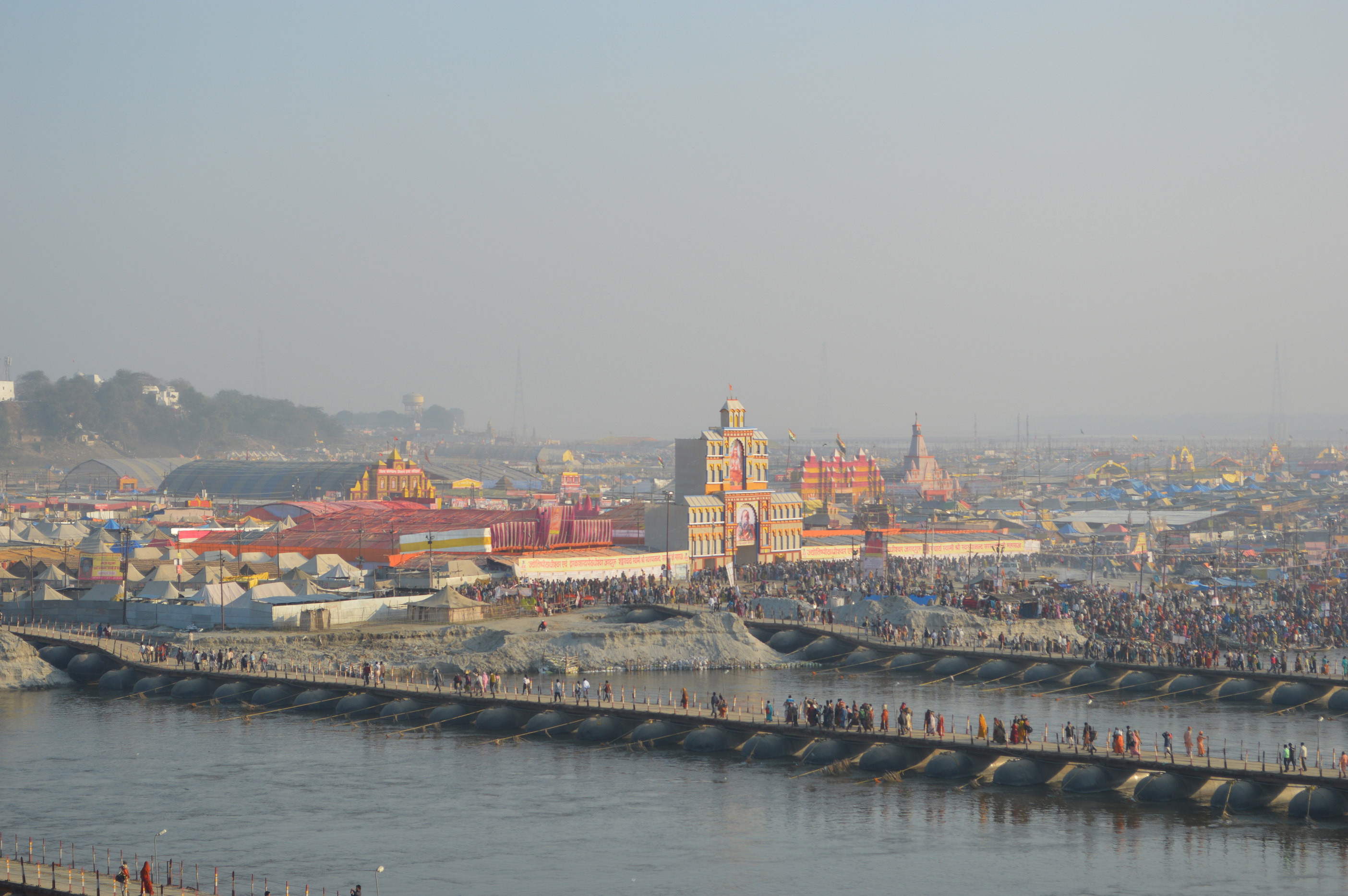
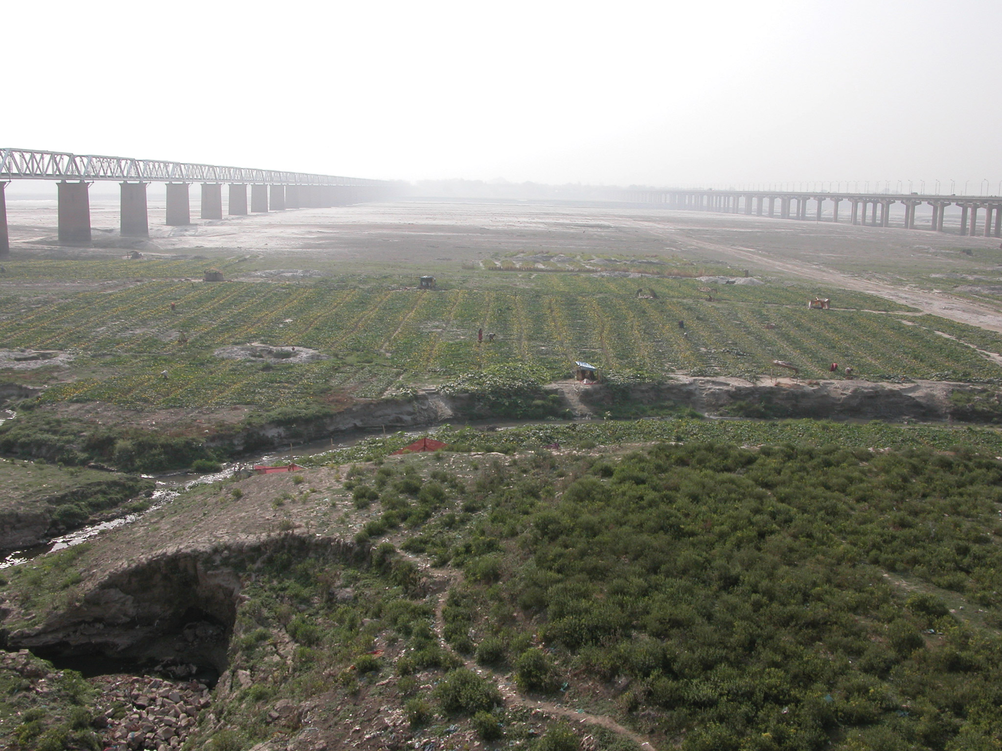
So for example, at the city of Allahabad, I’ve spent nearly a decade drawing and photographing how the Triveni Sangam, the site where the ‘largest gathering of humanity’ takes places very twelve years – the Kumbh Mela – goes from a densely populated gridded tent city to agricultural fields and pastures. Every year during the month of Magh (January-February) Allahabad hosts Magh Mela and erects a temporary city for millions of people to bathe at the confluence of the Ganges, Jamuna, and Saraswati rivers. Streets are laid out in a grid, pontoon bridges connect the banks of the Ganges with sandbars, and plumbing is laid to supply water for millions of pilgrims. Once the festival is over and the tents are gone, the grid of the city remains tattooed into the land. Farmers repurpose the grid to plant and harvest crops. When the monsoon comes in June-July though, everything is washed away. The following year the process repeats. This is a microcosm of the kind of cyclical changes that happen all throughout the Ganges basin every year.
A river changes so much during even just its daily cycle, not to mention seasonally. Could you expand upon how drawings of a dynamic river that continuously changes shape can be factual like an atlas?
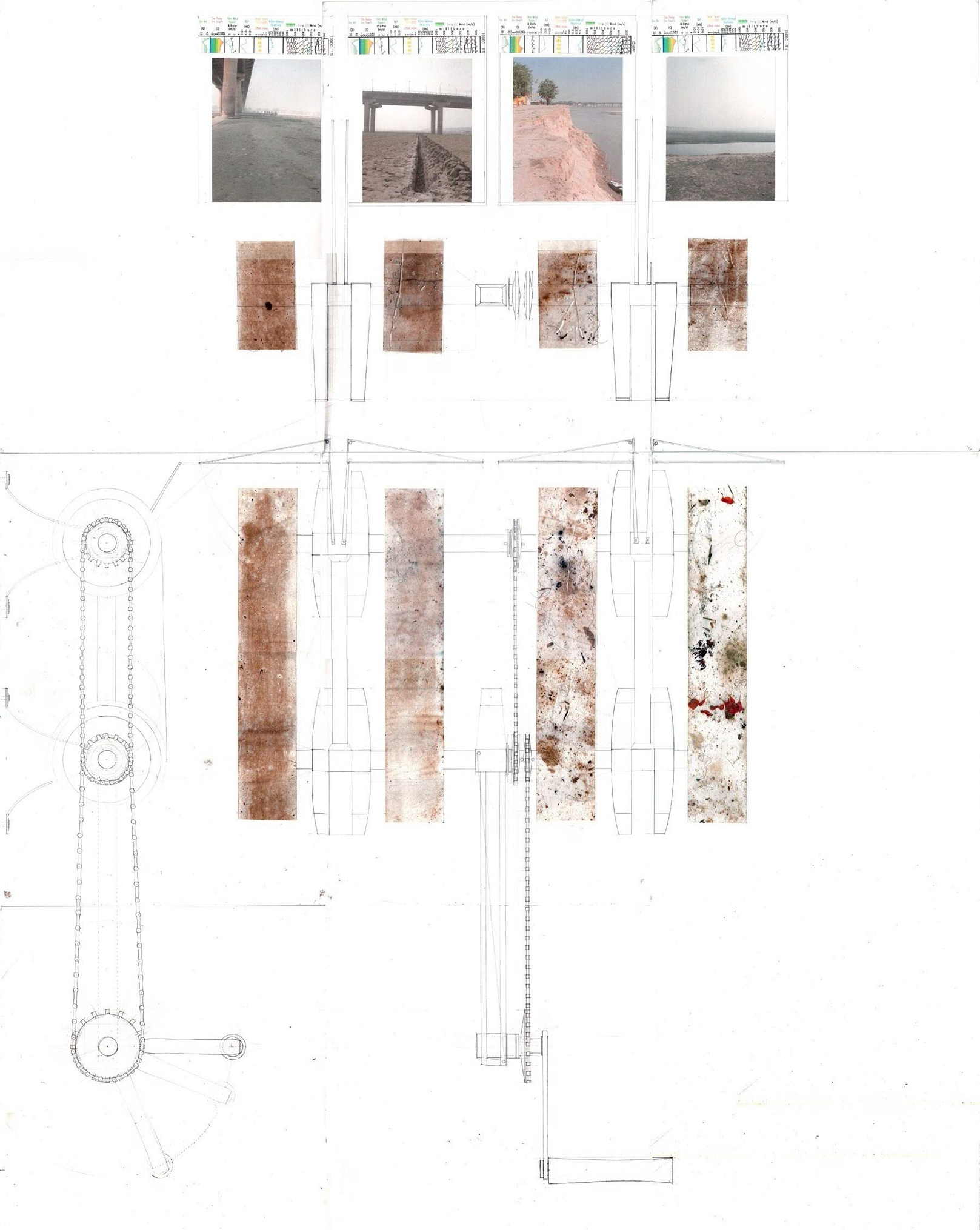
On one level, the approach I took is very empirical in terms of documenting the landscape. I chose specific sites either because of their geographic position, density of settlement, or agriculture. I routinely went back to document these same sites, so I was able to see, photograph, and then map out in plan and section how they transformed with the rhythms of the monsoons. But I also developed my own instruments to map and compare soil structures; you can tell just by the size of the grain of soil how that river is moving and what it was carrying.
What sorts of instruments did you make?
One of the instruments I created I call the ‘surface accumulation sleeve’, which is where I unroll packing tape along the ground for one kilometer perpendicular to the river’s edge. Soil, but also petrified human shit, hair, flowers, and other debris adhere to the tape, creating an index of the interrelation between the ground and cultural conditions in the area. I then scan that kilometer-long strip, disaggregate the soil sizes in Photoshop, and finally map out their distribution so as to know how that river expands and contracts over the course of the year.
In this process of inventing your own tools, and obviously mapping the unmapped, has there been any room for fiction?
I wouldn’t say these tools I developed are fictive, but they certainly test the subjectivity of measurement. Usually when I talk about this work I show Marcel Duchamp’s 3 Standard Stoppages and how he was able to construct an infinite number of meters just by dropping three different pieces of string that were each one meter long, and then carving each shape into a meter stick, which are all different, and yet all technically one meter in length. I took the making of a dynamic atlas as an opportunity to explore how one goes about measuring and being very playful with it as much as trying to develop highly measured drawings that can be useful to architects, landscape architects, historians, and policymakers.
When you were doing this research, did you keep your own kind of fictional travel log?
I kept a journal, but I had so many crazy things happen to me I didn’t feel the need to create fiction. Once, very early on in my research, I was mapping a canal; as I’m getting ready to make a panorama, three women approach me and from just a few meters away pull out machine guns. The first thing that comes out of my mouth in Hindi is: “आपका देश बहुत सुंदर है”, which means “your country is very beautiful”. I really had no idea why I said that – I must have just learned it in Hindi class. They looked at each other, then back at me, and just started laughing. Naxal fighters, or what the government refers to as Maoist rebels, controlled portions of the areas that I was exploring back in 2005 and 2006, and a large percentage of the fighting force is female. I have no idea if these women were Naxal fighters, but I very quickly had a sense of how contested some of the areas were that I was mapping.
In terms of territorial control and water management, who actually owns the Ganges River?
Well, there are a number of ministries that oversee it; different branches of the government own it, you could say. But many people would say that ownership is contingent upon what one defines as a river, which is a very difficult thing to settle with the Ganges. Where does the river begin and where does it end? Rivers aren’t just water, but the entire riverbed ecology and beyond. The Ganges moves more silt than just about any river on earth, so land in many areas is transient. And then there’s the relationship between groundwater and the river, which really extends and challenges what is commonly thought to constitute a river. So part of my research in the dynamic atlas is an investigation into groundwater infrastructure like tube-wells, where I try to rethink the river not just as a surface body of water replenished by the monsoon, but as an underground condition as well.
In today’s neoliberal age, with a lot of private companies wanting to ‘help’, how do you see the ownership of the river changing?
In the context of India, much like in all of the Commonwealth countries, landowners own rights to the water beneath their land, which limits the police powers of the state. So this has, on the one hand, led to more people managing their groundwater resources, but on the other hand a harsh socio-economic dynamic has arisen between those who have the means to pump water and those that don’t; many small family farms can’t afford to buy a tube-well. So technologies like the tube-well have assisted some in providing drinking water and irrigation, and yet it also remains out of reach for many people. As I write about in the book and elsewhere, the unregulated proliferation and decentralization of groundwater extraction can lead to devastating environmental effects in terms of rapid groundwater depletion, arsenic, salinization, etc.
Has this lack of legislation led to a quid pro quo?
Even without neoliberal policies, non-existent oversight has led to a state of anarchy. Because the government does not keep records or monitor tube-wells or most pump infrastructure, if you have the means to buy and sink a tube-well, then you simply can do so – even if it causes serious environmental problems. This is why the government and NGOs have no idea how many millions of tube-wells actually exist or where they are located in India. People don’t openly show where or how many tube-wells they have, but you can hear the sound of diesel powered pumps in the morning and evening in cities like New Delhi and Varanasi, as well as in small towns and villages.
Have there been many conflicts?
People are depleting their own water as well as the water underneath their neighbors land. Especially in the state of Punjab and the western regions of Uttar Pradesh there are ‘tube-well wars’ emerging where people sink deeper and deeper because the water level keeps dropping. This of course makes it more difficult for people who have limited means to access water and also creates all kinds of environmental changes to the area. Some of these ‘wars’ go to court, but in the state of Uttar Pradesh, where over 200 million people live in an area the size of Great Britain, the courts are so epically backlogged that it’s estimated to take 200 years of full-time work for the court to process all of the current cases. There are lots of reasons for this backlog, but, suffice it to say, taking legal action does not guarantee a timely outcome.
The World Bank is coming into the region with aid, and Israel is making efforts to clean up the Ganges. What is your take on these sorts of initiatives?
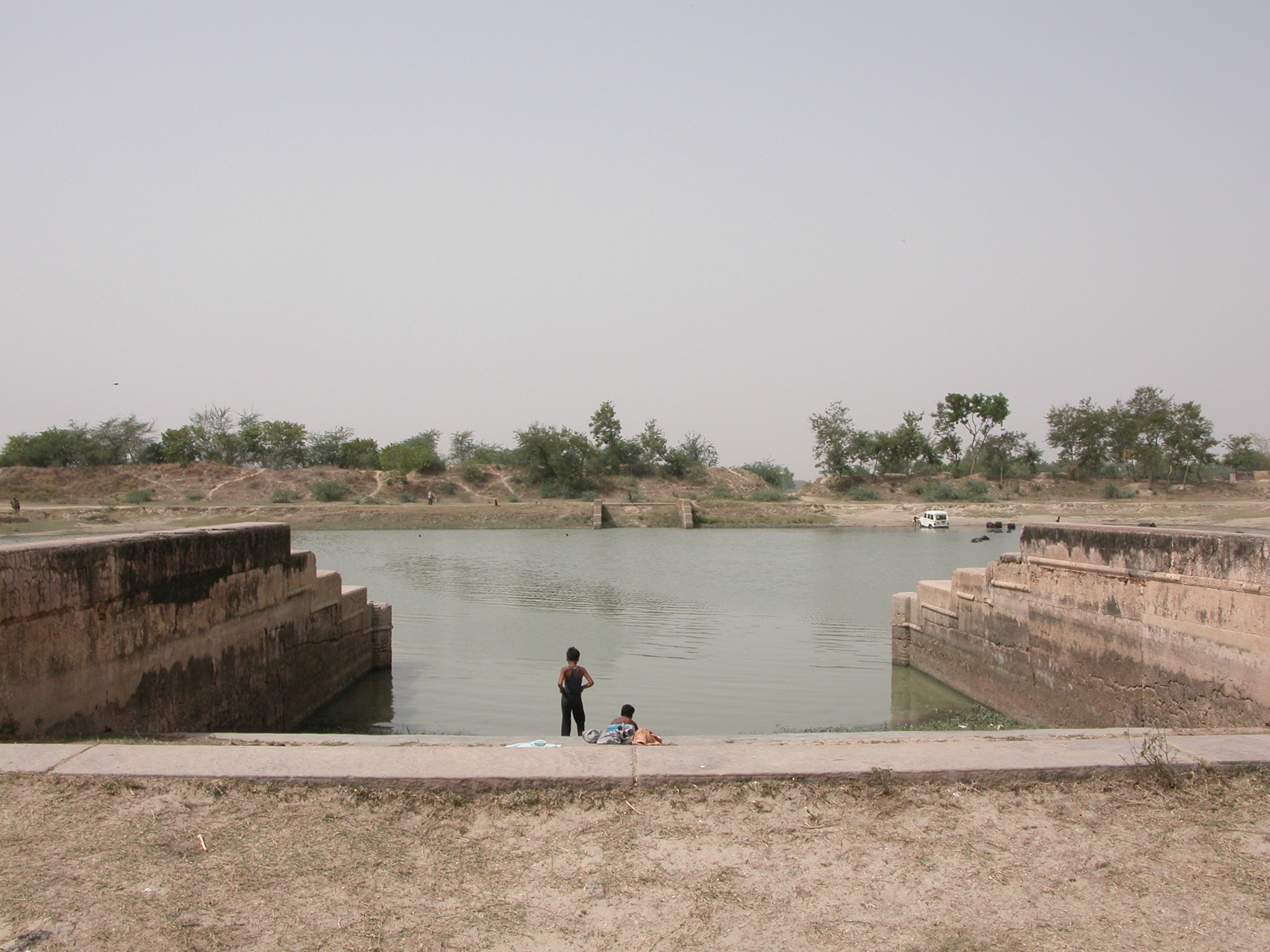
I think they are already facing great challenges. A lot of areas in northern India don’t have electricity for more than eight hours per day, so building sewerage treatment plants to treat wastewater around the clock is not going to work. Typical hard infrastructures used for storm management will not prove feasible either because there are thousands of nalahs (drains), where most wastewater enters the river. I’ve looked at how to create soft infrastructures that could be more effective, like paying farmers with lands along these nalahs above the price they would normally get for their agriculture to maintain bioswales and wetlands. The thing is, this takes a lot of time, and in a political cycle politicians tend to favor building technological monuments like sewerage treatment plants rather than bioswales and wetlands.
Have there been examples of interventions that have worked successfully?
There are some examples, like in Kolkata, where wetlands and bioswales have been put in place. These have proven successful in large part but they are always thought of as mono-functional infrastructures. Such myopic thinking is a huge problem in a densely populated context like India, and I think the Ganges river basin could be a fantastic laboratory to test and build more environmentally and socially attuned physical and social infrastructures. Transforming areas into bioswales and wetlands requires building economies, as well as starting to imagine, visualize and give measure to the dynamism of the basin. In Kolkata, you have a lot of people building homes in the wetlands and bioswales. So, again, maintaining these soft infrastructures are as important as building them.
How do you see water as a contested space or material connected to technological innovations?
I’m not a technological determinist so I don’t think technology necessarily drives society and culture, but certain technologies do allow people and institutions to make changes at many scales. Things always come at a price; the Ganges canal was constructed in the first place to mitigate famine in northern India, but it also artificially raised water table levels, which is often pointed to as the cause of malaria outbreaks, as well as served as a mechanism of territorial subdivision and colonial control. Testing and developing new modes of visualizing space and environmental change can help us gain new insights into spatial and political contestation, but they certainly cannot replace judgment.